Listen to this Post
Introduction:
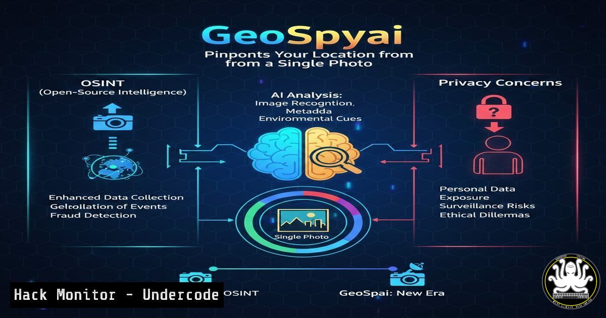
In the rapidly evolving landscape of Open-Source Intelligence (OSINT), a new frontier has emerged with GeoSpy.ai, an AI-powered geolocation platform developed by Graylark. Designed initially for government and law enforcement, this technology leverages advanced computer vision to analyze images and predict GPS coordinates with meter-level precision, even when all metadata (EXIF data) has been stripped. This capability transforms how investigators approach imagery intelligence (IMGINT) but simultaneously raises critical questions about digital privacy and operational security in the public domain.
Learning Objectives:
- Understand the underlying mechanics of AI-powered geolocation tools like GeoSpy.ai.
- Learn how to extract and analyze image metadata on Linux and Windows for OSINT purposes.
- Identify defensive techniques to protect personal media from AI-based location scraping.
You Should Know:
1. How GeoSpy.ai and Computer Vision Work
GeoSpy.ai, created by Graylark, does not rely on traditional metadata. Instead, it uses deep learning models trained on millions of geotagged images. The AI analyzes visual features that humans might overlook: the angle of sunlight (solar positioning), unique soil composition, vegetation types, architectural styles, and even specific signage or utility pole configurations. By cross-referencing these visual cues against a vast database of geographical data, the model predicts the most likely location where the photo was taken.
For security professionals, this means that simply stripping EXIF data from a photo before posting it online is no longer a sufficient privacy measure. The image itself becomes the data point.
- Manual Image Analysis: The ExifTool Deep Dive (Linux/Windows)
Before relying on AI, OSINT professionals must verify what metadata is actually present. While GeoSpy works without it, traditional investigation starts with extraction.
On Linux (using `exiftool`):
 Install exiftool
sudo apt install exiftool -y

Extract all metadata from an image
exiftool -a -u -g1 image.jpg

Extract specifically GPS coordinates if available
exiftool -c "%d° %d' %.2f\"" -GPSPosition image.jpg
On Windows (PowerShell):
While tools like ExifTool are cross-platform, Windows has native capabilities using the `Shell.Application` COM object, though it is less detailed.
 Load the shell application
$shell = New-Object -ComObject Shell.Application
$folder = $shell.Namespace((Get-Location).Path)
$file = $folder.Items().Item('image.jpg')

Get details (0-300 range properties)
0..300 | ForEach-Object {
$value = $folder.GetDetailsOf($file, $<em>)
if ($value) { Write-Host "$</em> : $value" }
}
Why this matters: This allows an analyst to verify if the poster stripped the data, or if they left a digital breadcrumb inadvertently.
3. Simulating AI Geolocation with Python and CLIP
While we cannot access Graylark’s proprietary model, security researchers can simulate the concept using pre-trained models like OpenAI’s CLIP (Contrastive Language-Image Pre-training) combined with geolocation datasets. This provides a technical understanding of how the “magic” happens.
Conceptual Python Script (Linux):
import torch
import clip
from PIL import Image

Load the model
device = "cuda" if torch.cuda.is_available() else "cpu"
model, preprocess = clip.load("ViT-B/32", device=device)

Load and process your image
image = preprocess(Image.open("suspect_image.jpg")).unsqueeze(0).to(device)

Hypothetical list of country descriptions
countries = ["a photo of a street in Paris", "a photo of a desert in Arizona", "a photo of a rice paddy in Vietnam"]
text = clip.tokenize(countries).to(device)

with torch.no_grad():
image_features = model.encode_image(image)
text_features = model.encode_text(text)
similarities = (image_features @ text_features.T).softmax(dim=-1)

print(similarities)
Note: This is a simplification; GeoSpy uses custom models trained specifically on geographical features, not just broad textual descriptions.
4. Defensive Measures: Adversarial Attacks on Images
If you are concerned about AI scraping your location from images, researchers are developing “adversarial patches” or perturbations—minor, often invisible changes to an image that fool AI models into making incorrect predictions.
Using Foolbox (Linux/Windows – Python):
You can test the robustness of an image classifier against adversarial attacks.
import foolbox as fb
import torch
import numpy as np

Assuming you have a pretrained model (e.g., ResNet)
model = fb.PyTorchModel(pretrained_model, bounds=(0, 1))
image, label = fb.utils.samples(...)

Apply a Projected Gradient Descent (PGD) attack
attack = fb.attacks.LinfPGD()
adversarial_image = attack(model, image, label)

The adversarial_image looks identical to the human eye but may fool the AI.
While this is a sophisticated defense, a simpler practical step is to use tools that slightly alter the image’s color spectrum or add noise, potentially disrupting the AI’s visual feature mapping.
5. Cloud Hardening: Protecting Your Own Image Databases
For organizations using cloud storage (AWS S3, Azure Blob) to store images, misconfigurations can leak sensitive geolocation data to scrapers or malicious AI.
AWS S3 Bucket Policy to Block Public Access (AWS CLI):
 Ensure no public access to your bucket
aws s3api put-public-access-block \
--bucket your-image-bucket \
--public-access-block-configuration BlockPublicAcls=true,IgnorePublicAcls=true,BlockPublicPolicy=true,RestrictPublicBuckets=true

Check for accidental data leaks (using Prowler - a security tool)
prowler aws --services s3
This prevents your private image collection from being used to train or query against unauthorized AI models.
6. Exploitation and Mitigation: Reverse Image Search Automation
GeoSpy is a specialized tool, but general-purpose OSINT often starts with reverse image searching. Automating this can help understand where an image has appeared online.
Linux Bash script using `curl` and `jq` (conceptual for Google Vision API):
!/bin/bash
 Requires Google Cloud Vision API Key
IMAGE_PATH=$1
curl -X POST \
-H "Authorization: Bearer $(gcloud auth application-default print-access-token)" \
-H "Content-Type: application/json" \
https://vision.googleapis.com/v1/images:annotate \
-d @<(cat <<EOF
{
"requests": [
{
"image": {
"source": { "imageUri": "gs://your-bucket/$IMAGE_PATH" }
},
"features": [
{ "type": "WEB_DETECTION" }
]
}
]
}
EOF
) | jq '.responses[bash].webDetection'
This returns web entities and matching images, providing a breadcrumb trail of where the image exists online.
7. API Security: Protecting Geolocation Endpoints
If you are developing a GeoSpy-like service, securing the API is paramount. You must prevent unauthorized access and data scraping.
Rate Limiting with Nginx:
http {
limit_req_zone $binary_remote_addr zone=geospy:10m rate=10r/m;

server {
location /api/v1/geolocate/ {
limit_req zone=geospy burst=5 nodelay;
proxy_pass http://your_backend_servers;
}
}
}
This configuration allows only 10 requests per minute per IP address, mitigating the risk of bulk data extraction by competitors or malicious actors.
What Undercode Say:
- Privacy is Pixel-Deep: The rise of AI like GeoSpy confirms that privacy is no longer just about metadata. The content of the image is the new metadata. Security awareness training must evolve to teach users that the background of a selfie—a tree, a mountain, a building—is enough to locate them.
- The Democratization of Surveillance: While GeoSpy is marketed for government use, the underlying technology will inevitably trickle down to private investigators, stalkers, and cybercriminals. Defenders must adopt “privacy by design” in photography, potentially using AI-driven adversarial tools to protect their digital footprint.
Prediction:
Within the next three years, we will see the emergence of consumer-grade “anti-OSINT” camera apps that automatically apply adversarial perturbations to photos before sharing them online. Simultaneously, social media platforms will face increasing pressure to detect and flag images that have been processed through geolocation AIs, as the line between public photography and real-time surveillance blurs beyond recognition.
▶️ Related Video (70% Match):
🎯Let’s Practice For Free:
IT/Security Reporter URL:
Reported By: Https: – Hackers Feeds
Extra Hub: Undercode MoN
Basic Verification: Pass ✅


