Listen to this Post
Introduction:
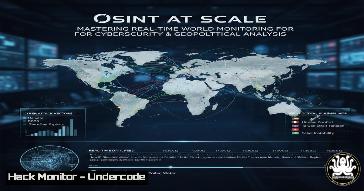
In the modern digital landscape, open-source intelligence (OSINT) is the bedrock of proactive security and geopolitical awareness. Real-time world monitoring maps have evolved from simple visual aids into critical data aggregation platforms, providing analysts with live feeds on military conflicts, natural disasters, economic shifts, and global movement patterns. For cybersecurity professionals, these tools are invaluable for contextualizing threat landscapes, understanding infrastructure dependencies, and predicting disruptions before they impact digital assets. This guide explores four powerful platforms that transform raw global data into actionable intelligence, offering a technical deep dive on how to integrate, verify, and utilize this information.
Learning Objectives:
- Identify and navigate four leading real-time world monitoring platforms for OSINT and GEOINT.
- Learn to extract, verify, and correlate raw data from mapping interfaces for cybersecurity threat modeling.
- Understand how to apply Linux and command-line tools to automate data collection from these sources.
- Develop skills to integrate global event data into security operations center (SOC) workflows.
- Assess the implications of open-source global monitoring for infrastructure hardening and risk mitigation.
You Should Know:
- Worldmonitor (https://lnkd.in/gRMmUPGU)
What it is and how to use it:
Worldmonitor is a comprehensive dashboard designed to aggregate news and real-time data regarding political unrest, economic announcements, and military mobilizations. Unlike generic news feeds, it geolocates incidents, allowing analysts to visualize the density of events in specific regions.
Step-by-step guide:
- Access the Platform: Navigate to the provided URL. Familiarize yourself with the legend, which typically color-codes events by type (e.g., red for conflict, blue for economic, yellow for natural disasters).
- Layer Analysis: Use the layer controls to toggle between “Military,” “Economic,” and “Civil Unrest” data. This helps isolate the specific threat vector you are monitoring.
3. Data Correlation:
- Linux Command: Use `curl` to check the API endpoints if exposed (often found in browser developer tools under Network tab). For example, to check for latency or data sources:
curl -I https://worldmonitor.example.com/api/events
- Verification: If the map indicates a power grid failure in a specific city, cross-reference with satellite data or local utility outage maps. This triangulation confirms the veracity of the OSINT.
- Threat Modeling: If a geopolitical conflict is flagged near a major undersea cable landing station or data center hub, note this as a high-priority risk for clients operating in that region.
-
Worldwatch UK (https://worldwatch.uk/)
What it is and how to use it:
Worldwatch UK specializes in maritime and aviation tracking, overlaying military and civilian movements onto a geopolitical map. It is essential for tracking supply chain disruptions, naval exercises near critical internet infrastructure, or unusual flight patterns.
Step-by-step guide:
- Filtering Traffic: Upon loading, the map will be dense with tracks.
– Action: Filter for military aircraft only. Note the transponder codes. If a military vessel turns off its AIS (Automatic Identification System), that “dark” period is a significant intelligence data point regarding potential covert operations.
2. Historical Playback:
- Action: Use the timeline feature (if available) to rewind and see the path of a specific vessel or aircraft. This is crucial for incident investigation—e.g., “Was there a surveillance ship near the cable break last week?”
3. Cybersecurity Application:
- Windows Command: Use `nslookup` or `tracert` to map the infrastructure of a shipping company affected by a naval blockade.
tracert shippingcompany.com
- This helps determine if your organization’s data traffic routes through undersea cables in that hostile zone, indicating potential for physical-layer interception or disruption.
- Glint (https://lnkd.in/gevmBPHN)
What it is and how to use it:
Glint focuses on real-time global security intelligence, specifically natural disasters and crises. It combines official government alerts with social media geolocation to provide a minute-by-minute update on events like earthquakes, floods, or terrorist attacks.
Step-by-step guide:
- Alert Configuration: While a web interface is standard, consider how you would ingest this data programmatically.
– Linux Automation: If Glint offers an RSS feed, you can automate alerts.
 Example script to fetch and parse RSS for keywords like "cyber" or "data center"
curl -s https://glint.example.com/feed.rss | grep -E "cyber|data center|power outage" | mail -s "Glint Alert" [email protected]
2. Impact Assessment:
- Scenario: A 7.0 magnitude earthquake hits a region known for semiconductor manufacturing.
- Action: Immediately correlate this with your asset inventory. Do any of your suppliers have fabs there? Use the map’s radius tool (if available) to see which industrial zones are within the disaster perimeter.
- SOC Integration: Create a dashboard that ingests Glint’s data. If a natural disaster is detected in a location where you have remote employees or branch offices, trigger an automated check-in and infrastructure failover.
-
Monitor the Situation (https://lnkd.in/gBaza4Dr)
What it is and how to use it:
This platform leans heavily into economic and political monitoring, tracking sanctions, protests, and legislative changes globally. For a security professional, changes in policy can lead to immediate cyber retaliation (hacktivism) or changes in data sovereignty laws.
Step-by-step guide:
1. Policy Change Detection:
- Action: Set up a Python script using `requests` and `BeautifulSoup` to scrape the site for specific keywords related to your industry, such as “GDPR,” “data localization,” or “sanctions.”
- Code Snippet:
import requests
from bs4 import BeautifulSoup</li>
</ul>

url = 'https://monitorthesituation.example.com'
page = requests.get(url)
soup = BeautifulSoup(page.text, 'html.parser')
headlines = soup.find_all('h3')  Hypothetical tag for alerts

for headline in headlines:
if 'sanction' in headline.text.lower():
print(f"ALERT: Sanction update - {headline.text}")
2. Predictive Analysis:
- If the map shows escalating political rhetoric and economic sanctions against a nation, predict a rise in state-sponsored phishing campaigns targeting entities in the sanctioning countries. Update your email filtering rules and threat hunting queries accordingly.
5. Data Verification and Enrichment Techniques
Ensuring the integrity of OSINT:
Maps are visual representations of data, but the data itself can be spoofed or lagging. Verification is key.
Step-by-step guide:
1. Cross-Referencing with Satellite Imagery:
- Use open-access satellite tools like Sentinel Hub or NASA FIRMS (Fire Information for Resource Management System) to verify claims of fires or troop movements shown on the monitoring maps.
2. Network Analysis:
- If a map indicates a “cyber attack” on a region, verify it by checking BGP (Border Gateway Protocol) route leaks or looking at internet outage graphs on platforms like Oracle’s Internet Intelligence.
- Linux Command: Use `mtr` (My Traceroute) to a server in the affected region to see where the packet loss begins.
mtr --report 8.8.8.8 Example to analyze routing to a public DNS
3. Social Media Geolocation:
- Use tools like `exiftool` on Linux to check geotags of photos posted from the incident zone, comparing the metadata location to the map’s incident marker.
exiftool image_from_incident_zone.jpg | grep GPS
6. Hardening Against Geopolitical Cyber Threats
From Observation to Action:
Observing a conflict on a map is passive; hardening your infrastructure in response is active.
Step-by-step guide:
1. Geofencing and IP Blocking:
- If the “Monitor the Situation” map indicates nation-state aggression from a specific country, proactively block traffic from that region if your business has no presence there.
- Web Server Config (Nginx):
Block traffic from a specific country using GeoIP2 module
if ($geoip2_data_country_code = "XX") {
return 403;
}
2. Cloud Infrastructure Hardening:
- If “Worldwatch UK” shows naval exercises near a cable landing station, initiate a failover to a different cloud region.
- AWS CLI Command: Shift traffic from `eu-west-2` (London) to `eu-west-1` (Ireland) if the physical infrastructure of the former is threatened.
aws route53 change-resource-record-sets --hosted-zone-id ZONEID --change-batch file://failover.json
What Undercode Say:
- Context is King: Raw data from world monitoring maps is meaningless without context. A military exercise in the South China Sea has different implications for a data center in Singapore than it does for a retailer in Brazil. The true power of OSINT lies in correlating global events with your specific digital footprint.
- Automation vs. Verification: While scripts can scrape and alert on global events, they cannot verify truth. The most effective OSINT practitioners blend high-speed data aggregation (using Linux tools like
curl,grep, and Python) with slow, methodical human analysis to filter out noise and deception. - The Physical-Digital Nexus: These maps are a stark reminder that cybersecurity is no longer just about code and firewalls. It is about undersea cables, satellite uplinks, and power grids. Incorporating GEOINT into your risk register is now a baseline requirement for enterprise security.
Prediction:
We will witness a rapid convergence of AI-driven predictive analytics with real-time mapping platforms. Within the next 18 months, OSINT tools will not just show you a protest happening now, but will predict the likelihood of that protest turning violent and targeting a specific telecom building based on historical data, social media sentiment analysis, and economic indicators. This will shift cybersecurity from reactive defense to proactive threat avoidance, fundamentally changing how we insure and architect critical infrastructure.
▶️ Related Video (82% Match):
🎯Let’s Practice For Free:
IT/Security Reporter URL:
Reported By: Https: – Hackers Feeds
Extra Hub: Undercode MoN
Basic Verification: Pass ✅🔐JOIN OUR CYBER WORLD [ CVE News • HackMonitor • UndercodeNews ]
📢 Follow UndercodeTesting & Stay Tuned: